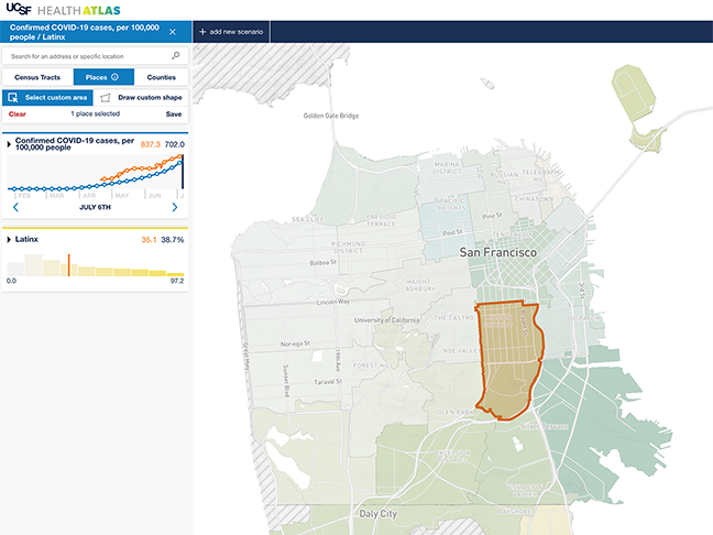
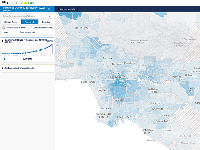
The UCSF Health Atlas, a population health mapping website led by the School of Medicine Dean’s Office of Population Health and Health Equity, recently added a new “places” feature that gives users the ability to visualize COVID-19 cases and neighborhood data down to the zip-code, neighborhood, and city levels. Places-level data offers the geographic granularity essential for identifying and understanding local COVID-19 outbreaks, especially in relation to the social and environmental factors that influence who has been able to shelter-in-place, and who has been at greater risk of infection.

“We know that there is a great deal of heterogeneity within counties, especially in a place like California, so looking at data at the sub-county level is key to understanding the epidemiology of COVID-19,” said Debby Oh, Health Atlas project lead and epidemiologist in the UCSF Department of Epidemiology and Biostatistics.

The heterogeneity within San Francisco is evident when comparing the number of confirmed COVID-19 cases per capita across San Francisco zip codes. As of July 6, zip code 94110, which corresponds to the Mission, had nearly 840 confirmed COVID-19 cases per 100,000 people, whereas zip code 94122, which corresponds to the Sunset, had fewer than 155 cases per 100,000 people. The UCSF Health Atlas allows users to investigate the relationships between this hyper-local COVID-19 case data and other demographic and neighborhood-level characteristics – such as overcrowded housing, car access, and unemployment – that play a large role in how quickly COVID-19 spreads. The importance of these social factors was made clear by the UCSF-led Mission Community Study, which conducted intensive testing in one Mission census tract and found that COVID-19 was heavily concentrated among low-income Latinx people who were unable to work from home. Insights from this study are highlighted in a new Health Atlas data story.

“To protect all Californians, we need to prioritize our public health efforts for people disproportionately affected by the pandemic. We know that sheltering-in-place is a privilege that is inextricably tied to social factors. The UCSF Health Atlas helps us better understand these factors as they relate to COVID-19,” said Kirsten Bibbins-Domingo, Vice Dean for Population Health and Health Equity in the UCSF School of Medicine.
Places-level data are also a crucial tool for tracking COVID-19 cases within large, heavily-populated counties. Los Angeles has a population of over 10 million, with residents spread throughout many unique neighborhoods.

While East Los Angeles has nearly 2300 confirmed COVID-19 cases per 100,000 people, Venice has under 340 cases per 100,000 people. Places maps allow us to more clearly see that although the virus can affect anyone, it does not spread equally.
Currently, the UCSF Health Atlas includes COVID-19 case data at the places-level, while COVID-19 hospitalization and death data are only available at the county-level. As more counties begin reporting places-level data, they will be incorporated into the site’s interactive maps.
